|
|
|||
|
|
|||
| Top > Service > 3D mobile surveying system | |||||||||
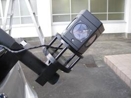
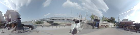
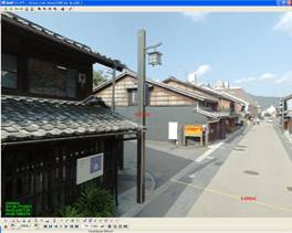
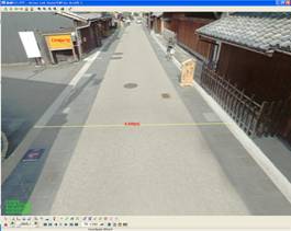
3D mobile surveying system Teikoku International Corporation added the Mobile Mapping System (IMS3), a 3D mobile surveying system, to its catalogue of surveying tools.
Until recently the acquisition of survey data for mapping purposes was carried out either via aerial means or on foot. In order to respond to the constant need to provide more accurate data faster the use of mobile surveying systems has been on the increase in recent years. The IMS3 enables the collection of 360 degree panorama vector data and graphics of the surveyed area, as well as relative distance and area measurements between landscape features to be made. It also allows measurements of absolute global coordinates to be made from the Global Navigation Satellite System (GNSS). Some of the uses this system can be put to include:
|
|||||||||
| Copyright (c) 2016 Teikoku International Corporation All rights reserved. |